

(CCTV footage of the 2026 Nepal floods in Gyirong Port)
As this dramatic CCTV image shows, the border crossing post at Gyirong Port, an essential waypoint for pilgrims travelling from India and Nepal to Mount Kailash (‘Gang Rinpoche’ – ‘snow jewel mountain’), in Tibet, was completely engulfed by ‘a massive brownish mudflow’ just before 11:00am on 26 August – barely 7 minutes after the Ms 5.2 seismic event some 20km upstream at Langtang Lirung triggered catastrophic flash floods and mudslides, resulting in the deaths of over 1,000 people, injuring many more and rendering several thousand homeless.
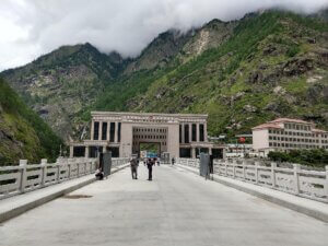
border crossing, 15 Aug 2019
Photo: ‘amitbalani’
Located in Nepal’s Rasuwa District, at the confluence of the Trishuli and Lhende Khola rivers, the Gyirong crossing had been transited by over 100,000 people in the first half of 2026, and accounted for 30% of all Nepal-China trade before the disaster.
Situated on the Tibetan side of the Nepal border, and close to the sources of four rivers (the Indus, Sutlej, Brahmaputra and Ghaggara), Mount Kailash, which stands 6638m (21,778’) high, was pronounced ‘utterly unclimbable’ in 1926 by Hugh Ruttledge (1884-1961), the deputy commissioner of Almora, Uttarakhand, and a keen mountaineer. Still unsummited, it has been forbidden territory to climbers for several years in view of its religious significance.
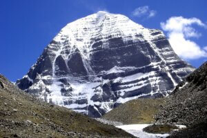
mountain’) Photo: Ondrej Zvacek
Considered sacred by Hindus (as the abode of Shiva), by Jains (as the place of moksha (liberation) for Rishabhadeva), by Buddhists (as the mythological Mount Meru), and by Bon followers (as the abode of Sipaimen and centre of the ancient Bon empire of Zhang Zhung), Mount Kailash is venerated by pilgrims who traditionally head for nearby Lake Manasarovar and then circuit the mountain – a journey of 33 miles (53 km), performed either on foot, over 3 days, or on bended knees – which can take up to 3 weeks.
The unprecedented events of 26 August are believed to have started when a large mass of glacial ice and bedrock broke off from the north face of Langtang Lirung (at 7,234 m (23,734 ft) – ‘the 99th highest mountain in the world’) and plummeted about 1,200m, before hitting the valley bottom and triggering an ice-rock avalanche (‘glacier collapse’) which continued to travel down the valley into the Lhende Khola river.
By the time it reached Gyirong Port, the resulting debris was travelling at a speed of around 50 metres per second (180 km/h; 110 mph). Floodwater reached settlements as high as 80 metres (270 ft) above the river level. Following the flood, more than 1.5m of silt was deposited in the main disaster zone.
On 27 August Times of India reported that over 500 Kailash-Manasarovar pilgrims, including 113 Nepalis, 133 Indians, and several smaller groups from a variety of different countries, were known to have been travelling in the area, or preparing to cross the Nepal-Tibet border, when the disaster struck. (Reported numbers of missing persons and identified casualties change daily, as more precise information becomes available).
The flood carried the bodies of victims up to 240 km (150 miles) away, with some being recovered as far downstream as Nawalparasi District in Nepal, and Kushinagar and Maharajgani districts in Uttar Pradesh, India.
Rachel Magowan
Ed Notes:
•For an illustrated explanation of the Langtang Lirung glacier collapse: Please see this Reuters article.
•For regular updates on casualty figures: Please see the Wikipedia page on the Nepal floods.
•To help the survivors: Please see the Foreign, Commonwealth and Development Office (FCDO) advice about making donations.
****************************************************************************************
(Suggestions for BACSA website news items, volunteering opportunities and diary entries, are always welcome – please send them to ‘comms@bacsa.org.uk’.)